Bruce Peninsula
Address
Bruce Peninsula
GPS
44.8827209, -81.17995364247
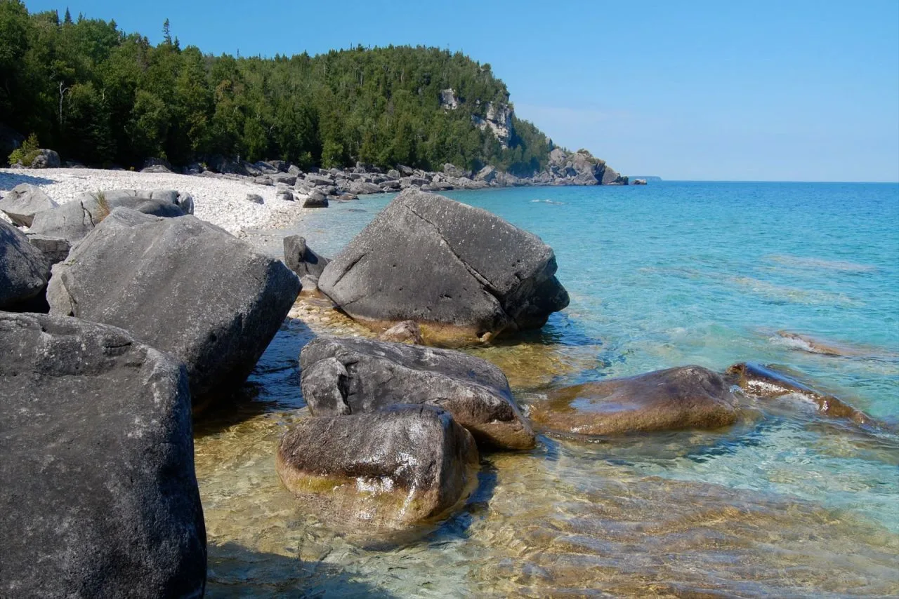
The Bruce Peninsula, located in Ontario, Canada, is a stunning geographical marvel that boasts rugged cliffs, crystal-clear turquoise waters, and lush forests teeming with diverse wildlife. This natural wonderland offers visitors a unique opportunity to explore its pristine landscapes through various hiking trails such as the famous Bruce Trail which stretches for over 800 kilometers along the peninsula’s edge.
 The Bruce Peninsula National Park is a protected area within this region that showcases the beauty of the Niagara Escarpment and Georgian Bay with its iconic Flowerpot Island featuring towering limestone formations shaped by centuries of erosion.
Outdoor enthusiasts can partake in activities such as camping, kayaking, or even scuba diving to witness the rich marine life thriving beneath the surface.
The tranquility and awe-inspiring beauty of Bruce Peninsula make it a must-visit destination for those seeking solace in nature’s embrace.
🌲 Bruce Peninsula: Key Facts & Figures
📍 Location
-
Located in Southern Ontario, Canada
-
Lies between Georgian Bay and Lake Huron
-
Part of Bruce County
-
Nearest towns: Tobermory (north), Wiarton (south)
🌄 Geography & Nature
-
Forms the northernmost part of the Niagara Escarpment, a UNESCO World Biosphere Reserve
-
Home to cliffs, karst formations, caves, and turquoise waters
-
Known for The Grotto, a famous sea cave with clear blue water
-
Over 500 species of plants, including rare orchids and ferns
🌿 Parks & Protected Areas
Bruce Peninsula National Park
- Size: 154 square kilometers (59.5 square miles)
- Managed by Parks Canada
- Includes the famous Grotto and Cyprus Lake
Fathom Five National Marine Park
- Canada’s first national marine park
- Area: 130 square kilometers (50 square miles)
- Features 22 shipwrecks and Flowerpot Island
- Popular for scuba diving, kayaking, and boat tours
🚶♀️ Activities & Attractions
-
Hiking: Over 100 km of trails, including part of the Bruce Trail
-
Scuba diving: Among the top freshwater diving destinations in North America
-
Birdwatching: Over 200 species of birds recorded
-
Camping: Several campgrounds including backcountry and car-accessible sites
🌎 Environmental Importance
-
Recognized as part of the Niagara Escarpment World Biosphere Reserve
-
Critical habitat for Massasauga rattlesnakes and Eastern bluebirds
-
Home to some of Canada’s oldest living trees: white cedars growing on cliff edges
🧑🤝🧑 Tourism & Economy
-
Receives over 400,000 visitors annually (pre-pandemic estimates)
-
Peak season: June to September
-
Major tourism drivers: nature, ecotourism, hiking, camping, photography
-
Closest major city: Toronto (about 4–5 hours by car)
🚗 Transportation & Access
-
Primary access via Highway 6
-
Chi-Cheemaun Ferry connects Tobermory to Manitoulin Island
-
Tobermory has a small airport for charter flights
🌡️ Climate
-
Humid continental climate
-
Cold winters, mild to warm summers
-
Average summer temperatures: 18–25°C (64–77°F)
-
Winter temperatures can fall below -10°C (14°F)